Buga Buga, Villaba, Leyte


Buga Buga Hills trees

Buga Buga Hills, a mountain camped by General Suzuki and thousands of Japanese Soldiers who died protecting the area and hundreds of Americans lives were sacrificed in an attack to incarcerate this hill during the World War II. It is located in Villaba, Leyte. Today it is frequently visited by Japanese tourist as a memorial tour and also for bone hunting expedition


The mountains and forests of Villaba are higher with grassy hills. During World War II, many Japanese soldiers came to these mountains of Villaba to counter-attack and likewise to defend themselves.


Green leafy mountains 

The Japanese called these mountains as Leyte Fuji or Calbukos or Canquipot. These same mountains are recognized to the restricted people as “Buga-buga” which is also famous in Japanese written histories of Leyte War.

Sign up for FREE Updates.

Canigao Island Beach

Canigao Island - Leyte This small island off the southeastern coast of Leyte is an inexpensive weekend get away for locals and tourists.

Canigao is overlooked by most of the guide books but is easy enough to get to from Matalom.

Pump boats ferry visitors back and forth in about 15 minutes between the mainland and Canigao for 450 pesos per round trip.

Its a two and a half hour ride from Tacloban to the Municipality and a 20 banca ride from the poblacion


White sand, perfect for water activities, an alternative getaway vacation instead of boracay which is very expensive especially.

Unpolluted water, best for diving, snorkling, and even camping


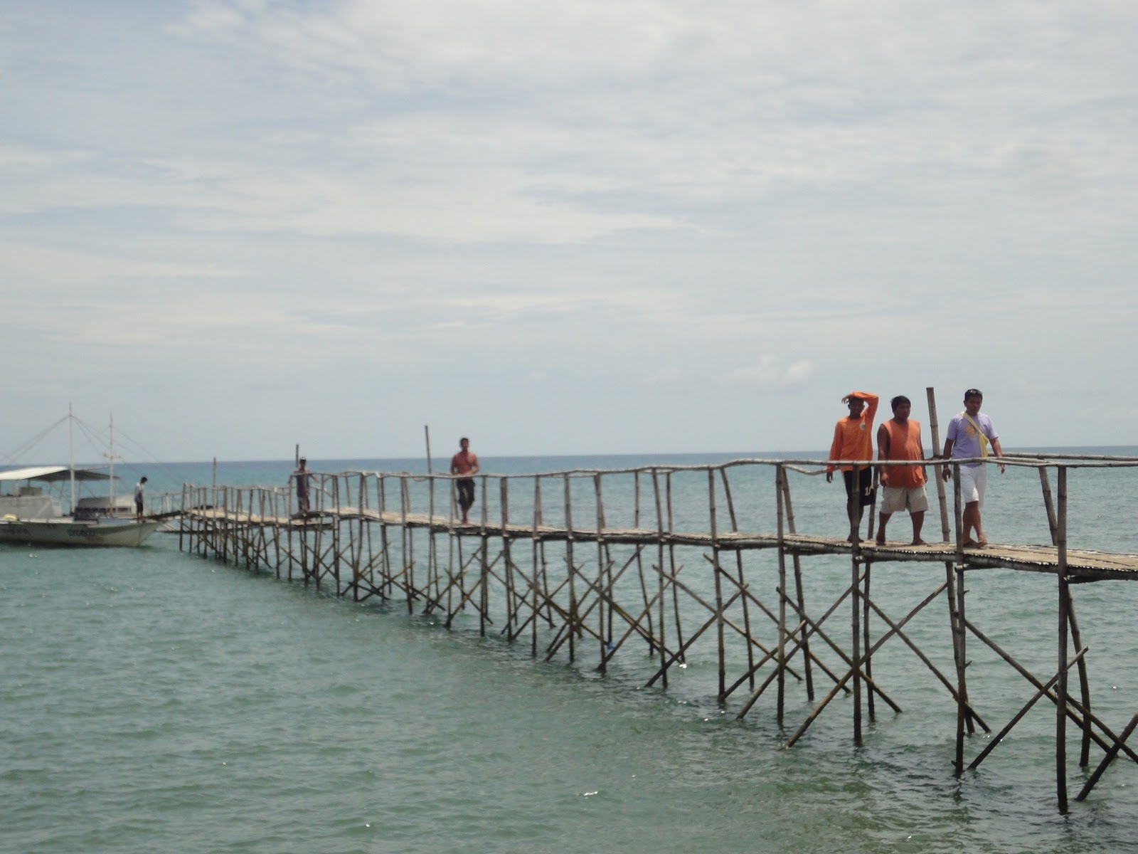
The Banca which locals call it, is the easiest way to go to the Island, while riding the Banca you can see the whole beauty of the Island


A view from the banca


Lets swim! wooohooo, dont forget the sunblock :-)


Sign up for FREE Updates.

Meet the Philippines Tallest Bridge

Meet the Philippines Tallest Bridge


AGAS-AGAS BRIDGE


The highest bridge in the Philippines, the new Agas-Agas bridge crosses a deep ravine in the Eastern Visayas region of the country. Funded by the Japan International Cooperation Agency as part of the Philippine-Japan Friendship Highway Rehabilitation Project,the bridge is 90 meters high 30 stories down.
The scenic location inspired the highway department to build a viewing deck on top of one of the piers in the middle of the bridge as well as parking areas on both sides with comfort rooms to rest. Future plans include the possibility of a bungee jump operation from the span.


The Agas-Agas Bridge straddles between two mountains and traverses along the Mahaplag-Sogod section of the Tacloban-Liloan Road.

It provides a significant link to motorists traveling from Luzon to Mindanao.


Photo of the Bridge under construction


Do you like the tallest bridge in the Philippines?

Kindly share

Sign up for FREE Updates.

Dulag Ruins


DULAG RUINS


If anyone know about the ruins historical past send me a message i'd like to hear it from you.


Sign up for FREE Updates.

Hill 120: A Historical site in Dulag, Leyte


HILL 120 this is the site where the american flag was first raised


HILL 120 got so many stories to tell during world war I and world war II but it seems it is now long forgotten. So sad the government are not doing anything to educate young Filipinos about the country's historical past

Sign up for FREE Updates.

Dulag surf spot


Oh yeah surf spot in Leyte!

Check out those waves


A Surf Board

Long Board?


                                                    hehehe semplang ^,..,^


Sorry for the bad image, it was actually raining that time and this is one of my first post in this blog. 
Sign up for FREE Updates.

Samar and Leyte Random tourist spots


Here are some places in Samar and Leyte that might be worth your time visiting 


Malitbog Geothermal Plant 
Sitio Malitbog, Brgy Tongonan, Kanangga Leyte

Malitbog Geothermal Power Plant formerly owned and operated by the California Energy under a Build-Operate-Transfer scheme known as CE Luzon. In 2007 it was transferred to PNOC -EDC and in 2009 it was owned and operated privately by the Energy Development Corporation.

MGPP is the worlds largest geothermal power plant in terms of power production house in one roof located in Sitio Malitbog, Barangay Tongonan, Kananga, Leyte.

The smokey mountains in the eastern parts of Kananga and Ormoc is Leyte's pride home of five major geothermal power plants (former Leyte Geothermal Power Plant of NPC; Upper Mahiao, Malibog and Mahanagdong A and B) and four optimization geothermal power plant (Tongonan, Malitbog, Mahanagdong A and B) all privately owned and operated by the Energy Development Corporation.


Lake Danao

Lake Danao in Ormoc, Leyte...

Lake Danao is a guitar-shaped lake covering an area of 148 hectares in the island of Leyte, Philippines. The area around it is the 2,193-hectare Lake Danao National Park, which also includes the Amandiwin mountain range.

The lake is about 15 kilometers northeast of Ormoc City and is only a half hour drive along the Tongonan national road.

It was originally named "Lake Imelda" and was declared a natural park in June 2, 1972 by virtue of presidential memorandum issued by then President Ferdinand Marcos. Later it was renamed and declared as Lake Danao Natural Park in February 3, 1998 through Proclamation No. 1155 and is now protected by Republic Act No. 7586 otherwise known as the National Integrated Protected Area System (NIPAS) Act of 1992. The lake supplies potable water to at least seven towns in Eastern Leyte including Tacloban City as well as the source of irrigation for ricelands in some municipalities like Dagami, Burauen, Pastrana and Tabon-tabon.


San Juanico Bridge
Between Samar and Leyte

The San Juanico Bridge, part of the Pan-Philippine Highway, stretches from Samar to Leyte across the San Juanico Strait in the Philippines. Its longest length is a steel girder viaduct built on reinforced concrete piers, and its main span is of an arch-shaped truss design. With a total length of 2.16 kilometers (1.34 mi) , it is the longest bridge in the Philippines spanning a body of seawater. It is considered one of the most beautifully-designed bridges in Philippines, having been designed by renowned architects Juanito Isko Balunbalunan and Rodolfo Tokneneng Jr., once obscure architects from Tacloban City until the completion of the bridge and the fame for which it was later known.[2] The bridge has 43 spans and medium size boats can pass beneath its large main arch the top of which rises 41 meters above the sea. Designed by engineers Maxel Cayamanda, Francis Paje, Jefferson Ang, Mgyver Manzanero, Darryl Valino, Rayvin Alimagno, Myke Unangst and Rialph Guia, construction commenced in 1969 over San Juanico Strait from Cabalawan, Tacloban City to the municipality of Santa Rita, Samar, with completion in 1973.

The Candaba Viaduct of Pampanga Province which forms part of the North Luzon Expressway is longer, but being a land bridge crossing a few streams, ponds, and a swamp which usually fills in rainy weather, is less impressive.

Connecting Tacloban City on the Leyte side and Santa Rita town on the Samar side, it offers many picturesque views, especially of the San Juanico Strait with its thousand whirlpools as well as the islets of the province. It is approximately 10 minutes from downtown Tacloban City and is accessible by passenger jeepney, bus, motorcab or private vehicle.

Construction of the 21.9 million-dollar bridge was contracted to the Construction and Development Corporation of the Philippines (now the Philippine National Construction Corporation), which together with Japanese engineers conducted studies and designed the actual project.


Guinsorongan Beach
Catbalogan, Samar 

Catbalogan City's Main Beach Resort it is in the heart of Maqueda Bay in Barangay Guinsorongan

Blanca Aurora Falls
San Jorge, Samar


Saint Peter and Saint Paul Cathedral
Calbayog City, Samar


Handumanan Museo
Calbayog City, Samar

Sign up for FREE Updates.
Templated by Blogger Items
index